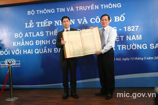
On behalf of Ministry of Information and Communications, Minister Nguyen Bac Son received the World Atlas, published in Brussels in 1827
Attending the ceremony were Minister of Information and Communications Nguyen Bac Son; representatives of Central Propaganda Department; Ministry of Foreign Affairs; Ministry of Natural Resources and Environment; Ministry of Public Security; Ministry of Agriculture and Rural Development ...; representatives of Embassies: People"s Democratic Republic of Laos; Indonesia; Philippines; Cambodia; Thailand; Republic of France; South Korea; India; etc.
In 1827, Philippe Vandermaelen (1795-1869), the remarkable geographer, member of the Paris Geography Association, published the World Atlas that comprises 6 volumes with 7 general maps of five continents, 381 detailed maps, 40 pages of statistics and a lot of information on natural, political and mineral geography. The Asian volume has 111 maps, mainly arranged in volume two of the Atlas. Vietnam was introduced at that time through the maps number 97,105, 106 and 110. Partie de la Cochinchine is the map 106 where the central coast line was drawn from the 12th Parallel to the 16th Parellel. In the high sea, Paracels (Hoang Sa) was drawn in detail and preciseness from about the 16th latitude to the 17th latitude and from the 109th longitude to the 111th longitude. The Paracels archipelago in the map has Pattles and Duccan islands in the west; Tree and Lincol, Rocher au desus de l’eau in the east and Triton in the southwest, right below the 16th latitude; Investigateur is deep to the south at about 14.5th latitude. Apart from the area determined as the Paracels, the map has also another map which introduces in short the Empire of An Nam.
The Partie de la Cochinchine is the first map that mapped out in an absolutely precise manner the position (latitude and longitude), geographical characteristics, the Western name of the biggest and most important island in the Hoang Sa archipelago. The map placed in the Cochinchine region was an organic and inseparable part of Empire An Nam. It proves clearly and precisely Vietnam’s sovereignty over the internationally recognized Paracels.
The World Atlas of Philippe Vandermaelen in general and the Partie de la Cochinchine in particular can be considered in all aspects as the priceless document that not only raises the standard scientific value of the propaganda and education of sovereignty over islands and sea, but also is the convincing, true and effective evidence and international legal value for the struggle to defend the sacred sovereignty over islands and sea of the Fatherland of Vietnam.
Mr. Ngo Chi Dung, General Director of the ECO Pharmaceuticals Company has funded for carrying out the survey of 5 sets of Atlas in the national libraries in France and Belgium, the Geographical Library of Royal Belgium, the library of Paris University; having discussion and unanimous assessment of the geographical experts, topographers, historians, lawyers and librarians in Paris and Bruxelles so as to be able to have the foundation to determine the World Atlas of the ancient Bookstore Sanderus, No. 32, Nederkouter, Gent City, Belgium, as the original in Bruxelles in 1827. After having important information, he decided to buy the complete set of 6 World Atlas to help make fuller historical and legal evidences concerning Vietnam’s sovereignty over the Paracels.
Speaking at a ceremony, Minister Nguyen Bac Son said the situation in the East Sea was complicated by China’s illegal placement of rig Haiyang Shiyou - 981 in Vietnam’s exclusive economic zone. However, Vietnam was persistently abiding by the 1982 United Nations Convention on the Law of the Sea (UNCLOS) and the Declaration on the Conduct of Parties in the East Sea (DOC). The minister described the Atlas as a valuable document, and thanked scientists, organisations and individuals for their efforts in collecting the maps. According to the Minister, within its functions and tasks, Ministry of Information and Communications in the future would continue to promote collections, evaluations, publications of documents, maps and other publications related to Vietnam’s sovereignty over islands and sea.